Pratomagno is a mountainous area about 30 km long that rises between the upper Valdarno and the Casentino north-west of the city of Arezzo; it involves the province of the same name and, to a small extent, the south-eastern portion of that of Florence.
It is located in the eastern part of Tuscany, close to the Apennine ridge.
The mountainous slope of Pratomagno Valdarnese, facing south-west, is full of many small treasures that it gives to all those who venture along its paths.
The numerous streams and ditches that run through Pratomagno descend almost parallel towards the Arno.
Time has helped them to excavate the characteristic profile consisting of numerous valleys and as many buttresses that descend towards the valley.
The ridge, on the other hand, shows much more rounded shapes, shaped by wind and snow, where the vegetation is made up of a continuous grassy sward (prairie).
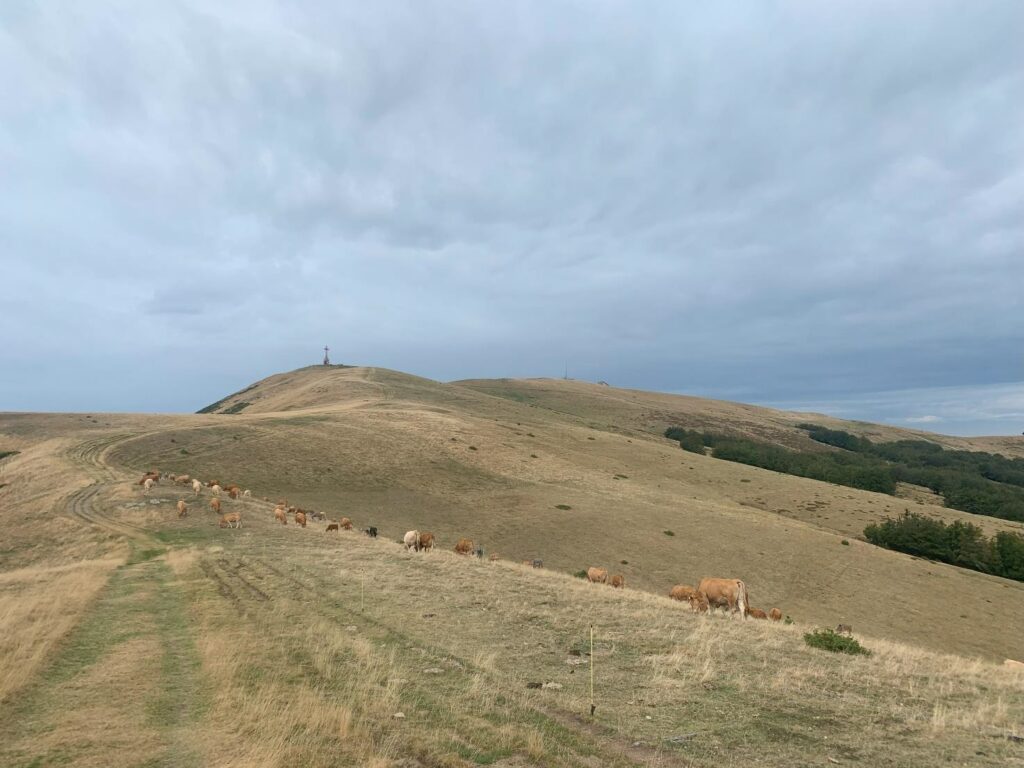
The highest peak of the mountain massif reaches an altitude of 1592 meters and is called the Pratomagno Cross. The Pratomagno Cross is a monument that was inaugurated on September 2, 1928: it is a large modular iron cross that dominates the entire massif and is visible even from a great distance.
In November 1966, due to bad weather, the upper part collapsed and was later relocated in 1969; On July 27, 2013, the inauguration of the new restoration and redevelopment of the place was made.
The municipal territories that extend on the slopes of Pratomagno are those of Poppi, Montemignaio, Castel San Niccolò, Ortignano Raggiolo, Castel Focognano, Talla, Loro Ciuffenna, Castelfranco Piandiscò in the province of Arezzo; Reggello, Pelago, Rufina and Londa in the province of Florence. The ridge is clearly bordered to the east, south and west by the Arno river.
In the examination of the surface geological formations, a clear prevalence goes to the sandstones of Monte Falterona which constitute the essence of the Pratomagno massif, which emerged from the ancient sea about 5 million years ago.
The variable conformation of the territory gives rise to considerable microclimatic variations that naturally reflect, together with the rainfall, on the vegetation of the entire area, where you go from the Mediterranean scrub with various terraces to olive groves to oak woods, from chestnut to beech passing through fir, up to the extensive ridge pastures.
The flora and fauna are rich in species.
On the top of Pratomagno the Australian flyer and hero of the First Australian World War Herbert John Louis Hinkler crashed during an attempt to travel from England to Australia.
A commemorative plaque commemorates the tragic event that probably took place on January 8, 1933.
The west side of the mountain is particularly suitable for free flight in paragliding and hang gliding, an activity practiced in the area above Reggello and Vallombrosa.
Descending the east side along the panoramic road you enter the Casentino valley.
The first inhabited village you come across is the ancient stone village of Quota.
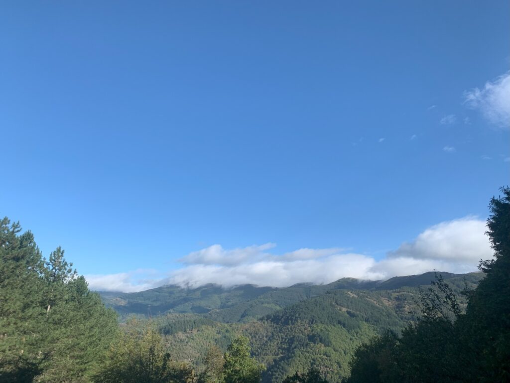
Especially in summer, Pratomagno is a destination for cyclists and hikers. Pratomagno is a very scenic place, especially towards the south-southwest direction; in fact, the gaze ranges from the Tuscan-Emilian Apennines to Monte Amiata and Monte Cetona towards Lazio, and up to the peaks that divide Umbria from the Marche (Sibillini Mountains).
Pratomagno as seen by Smart Walking
Trap.
They say it is called this because in the past it was a trap for enemies who tried to conquer the ancient castle that stood here.
Now, however, it is a trap for those in search of tranquility.
Which is not lacking here since in winter there are just 13 residents and in half a day of wandering through the alleys you have already met them all.
Three hundred is the maximum number of people present, which is reached in summer when all the second homes are populated.
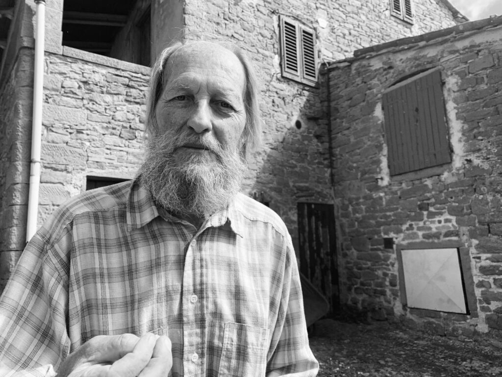
Paolo tells us what it’s like to live in Trappola.
He is one of the eleven inhabitants who spends the winter in this mountain hamlet of the Municipality of Loro Ciuffenna.
Trappola is located at 850 meters above sea level, on a sort of spur that emerges from the steep slopes of Pratomagno in Valdarno.
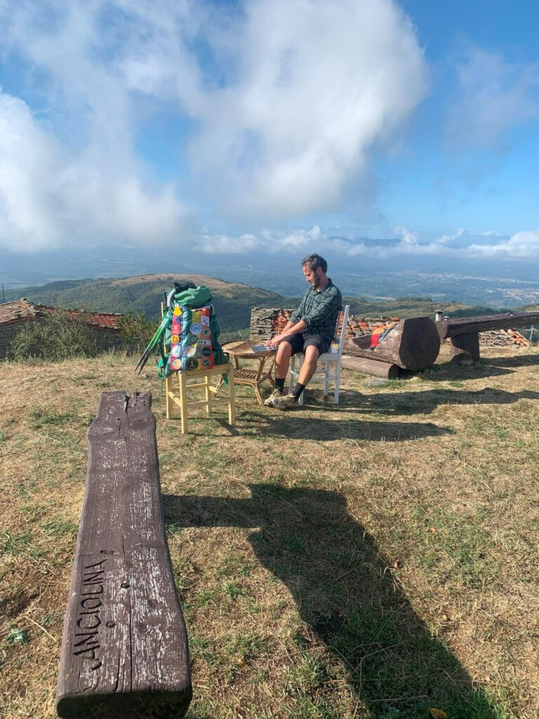
So you don’t want to go away from here, especially if you find a place like the Orma del Lupo hostel from which you can work while enjoying the silence and the view of Pratomagno.
The hostel – the first project launched by the Pratomagno Community Cooperative – has rooms, a kitchen, a large common room, a Wi-Fi that also takes you to the garden.
It is perfect for digital nomads who want to enjoy nature during NOT working hours, since it is possible to walk on the many paths in the area.
“With the verses that, without pretensions,
We now want to give you as a gift
We ask you, with our hearts, for forgiveness
For the one who no longer believes in You.”
(Taken from Leonardo Bonci’s poem, Alla Trappola)
The wind blows on Pratomagno.
But they say it’s nothing.
When the massif is really swept the force of the wind does not make you stand and in 1966 he pulled down the Cross, symbol of this place.
And ninety years ago snow and wind enveloped Herbert “Bert” Hinkler, the Australian pilot who attempted the feat of reaching Australia from London.
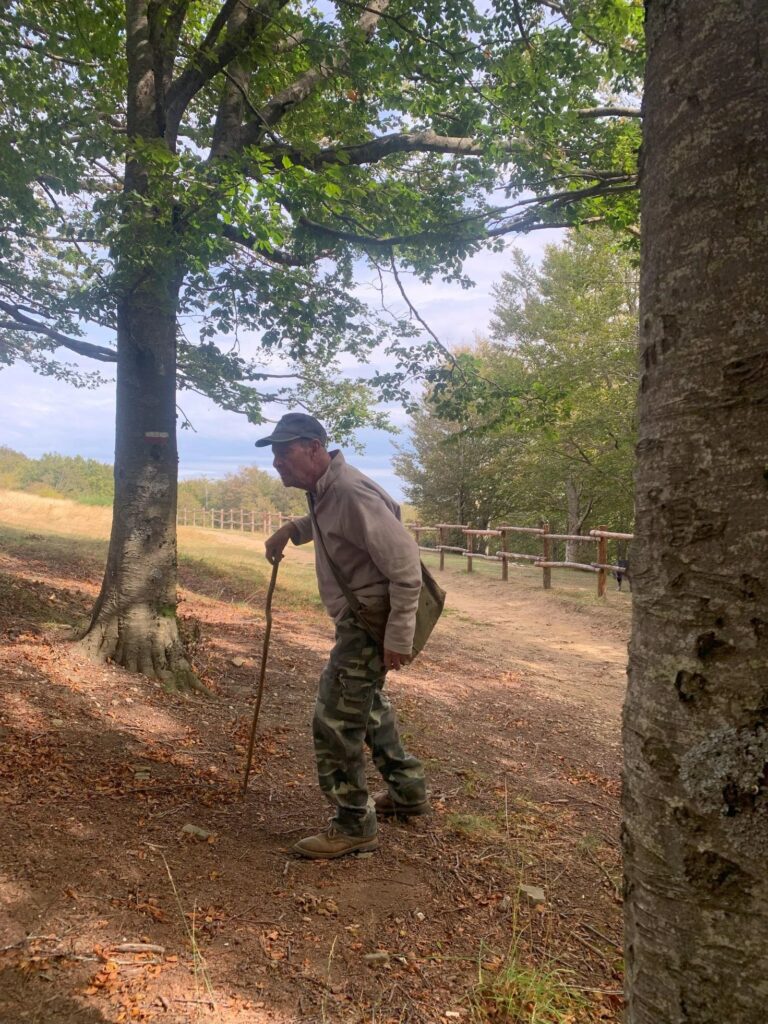
In the same days Corrado was born, he too for ninety years on Pratomagno.
Of life and sticks, of walks and mushrooms.
A place of legends and stories, this Pratomagno Massif, a 30 km long mountain, which runs parallel to the Apennine ridge on one side and the Val d’Arno on the other.
The name derives from the ridge meadows that remind me of sheep tracks.
From the 1590 meters of the Cross, the eye can range 360 degrees and trains one’s geography culture.
I recognize Lake Trasimeno to the southeast, Mount Amiata to the southwest; to the east the Casentino forests and to the west the Chianti.
To the north Florence and the Cimone and far to the northwest the Apuan Alps.
They tell me that on clear days you can even see Corsica!
Thanks to Lara and Claudio of Il Bosco magico Pratomagno for this day.
The Pratomagno Community Cooperative was born from the intention of a group of inhabitants and businesses of the Upper Valdarno to oppose the abandonment of the Pratomagno Massif and the consequent underuse of the natural and human resources of which this mountain area is rich.
These are the objectives that as a Smart Walking project I fully share!
- Countering abandonment
- Encouraging conscious tourism
- Bringing the shops back to the mountain hamlets
- Sharing knowledge and creating new businesses
- Reinvest in new mountain projects
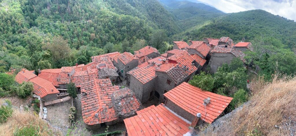
The circumnavigation of the mountain is a journey into the many small treasures, small stone villages.
There are 26 mountain hamlets in which 17735 inhabitants survive.
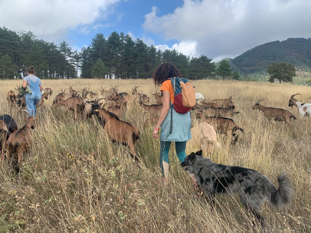
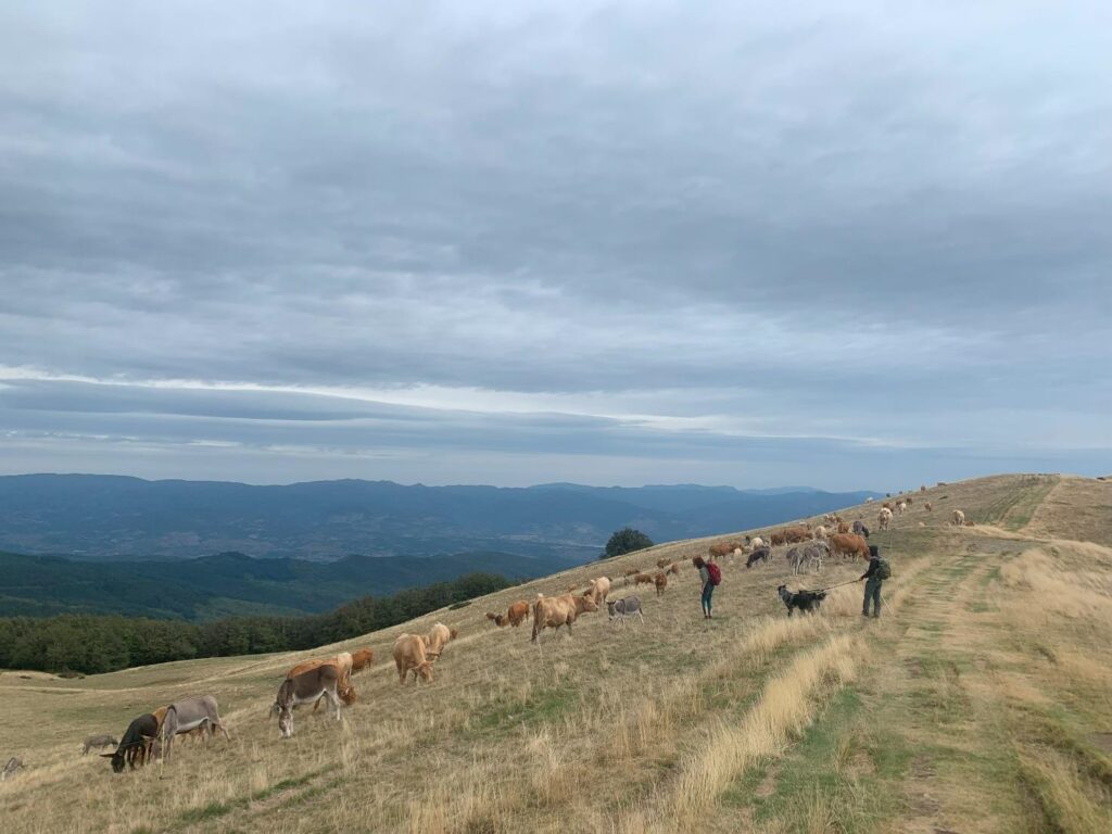
The Capre Diem farm has about 50 goats.
Chiara, born in 1990, takes them to pasture every day.
We met her in the company of her 5 livestock guarding dogs.
The goat cheese that she and her husband produce can be eaten at the shop in Chiassaia.
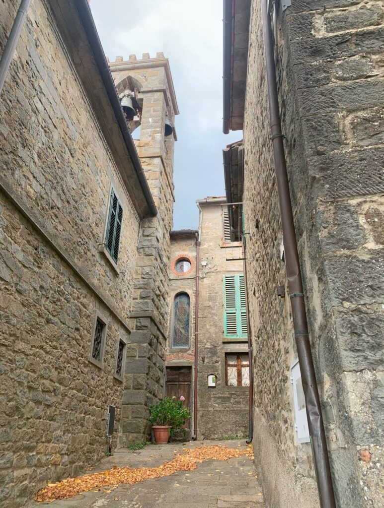
Chiassaia, Anciolina and Rocca Ricciarda are three small hamlets of Loro Ciuffenna clinging to the western side of the massif. A handful of people populate these places.
It would seem crazy but perhaps we citizens are crazy who trade the essence of life for vile comforts.
Anciolina is located at an altitude of 933 meters and is located on the southwest slopes of the Pratomagno massif.
The origins of this village are certainly very ancient, perhaps prior to the Etruscan civilization.
The type of workmanship of certain fragments and metal objects found, in particular a bronze axe, suggest that there was a settlement of the Umbrian people here.
The name Anciolina itself is likely to derive from the Umbrian term “ancla”, i.e. eagle.
As do these large birds of prey that like to nest among sheer rocks, the small town is located on a sort of spur on the slopes of Pratomagno which in this area descend steeply towards the Agna stream.
The oldest, but well-maintained, houses of Anciolina are largely located around a sort of small grassy hill.
It is called Casalone and is the panoramic point par excellence.
On its summit was the castle, considered impregnable.
There is no trace of this today.
From the Middle Ages to the beginning of the twentieth century, when Anciolina had its demographic boom reaching about one hundred and fifty inhabitants, the local people lived mostly with the cutting of the woods and sheep farming that in the cold months faced the transhumance towards the Maremma.
After the Second World War, Anciolina had a progressive demographic collapse and today does not reach thirty permanent inhabitants.
But during the summer the shutters of the well-ordered houses along the narrow alleys reopen and the small village seems to warmly welcome visitors.
Chiassaia (787 m), a village lying at the foot of the Cavalmorto, of ancient origins, is mentioned in a document of 1681 as a municipality belonging to the territorial district of the Rocca di Lanciolina.
At the entrance to the village you can park in front of the church, from which you can admire a beautiful view of the valley.
The place is also worth a stop for the fantastic schiacciata that the oven with the adjacent shop can serve you, alone or stuffed with local cheeses and cold cuts, to be enjoyed comfortably seated at the wooden table in the square adjacent to the shop, under the shade of a tree.
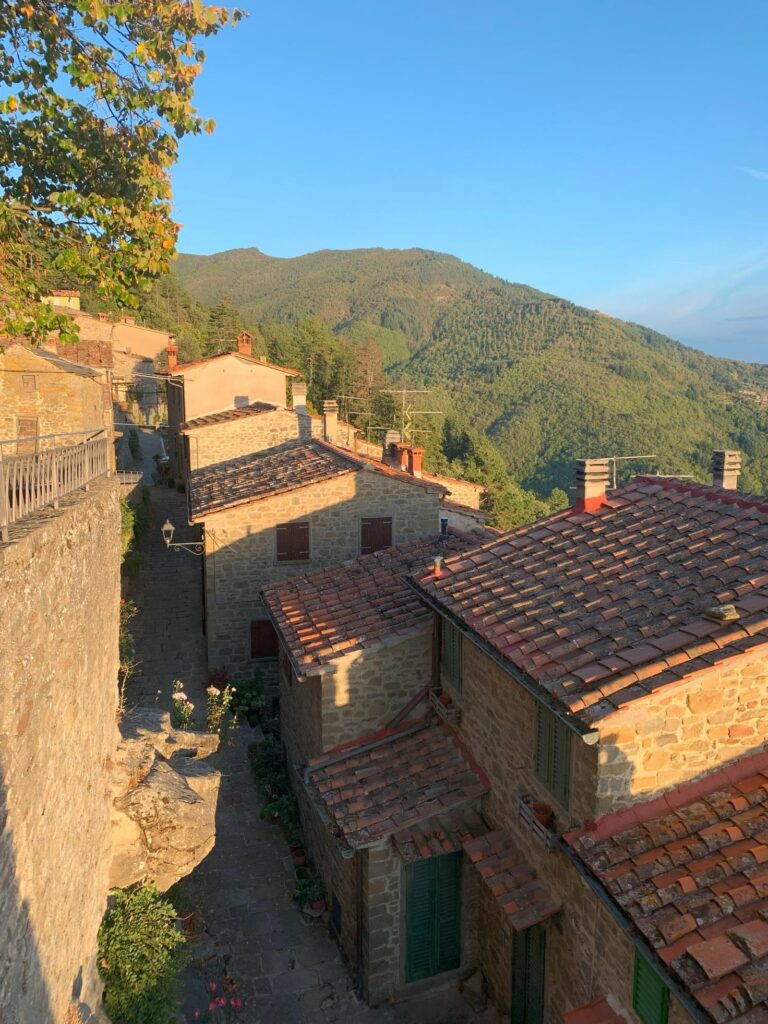
One of the most characteristic hamlets is undoubtedly Rocca Ricciarda; this ancient medieval village is located at the sources of the Ciuffenna river, about 12 km from the municipal capital and is on a spur of rock at 957 meters above sea level, just below the Pratomagno Cross, an ideal place for interesting excursions on foot following the signs with the various travel times.
The village was born at the foot of a castle, known since 1191, of which the ruins remain on the slope towards Pratomagno.
Its remains have constituted the archaeological park of the fortress since 2003.
A long work, which began in 1997 with the excavations conducted by the University of Florence, also led to the recovery and consequent renovation of the remains of the castle and its perimeter walls.
The arrival at the tiny village in Valdarno is preceded by a huge stone boulder that always invites the little ones to a short but suggestive climb.
At the entrance to the town there is immediately the small bar-restaurant renowned for its delicious chestnut fritters, continuing you enter the heart of Rocca Ricciarda with narrow paved alleys and glimpses of breathtaking views.
It should be noted that in some corners of the town the stone of the houses is still blackened because during the Second World War it was completely set on fire.
At the end of the village “at the Poggio wing” there is a very rare example of a cemetery with holes built after the Napoleonic edict of 1804 which architecturally recalls both a Romanesque church and a pagan temple.
A panoramic iron staircase leads to the castle that dominated the town and the valley and where important archaeological finds have been found.
The Pratomagno community has also created a passport, which obviously never expires, whose purpose is to be a diary and a special reminder.
It is to be used when visiting the valleys, during mountain excursions, when stopping at refuges and wherever there is an opportunity to mark one’s passage with stamps and notes.
If you haven’t been to Pratomagno yet, I recommend you go!